Around the Visitor Mine F60: Lost Villages and New Paradises

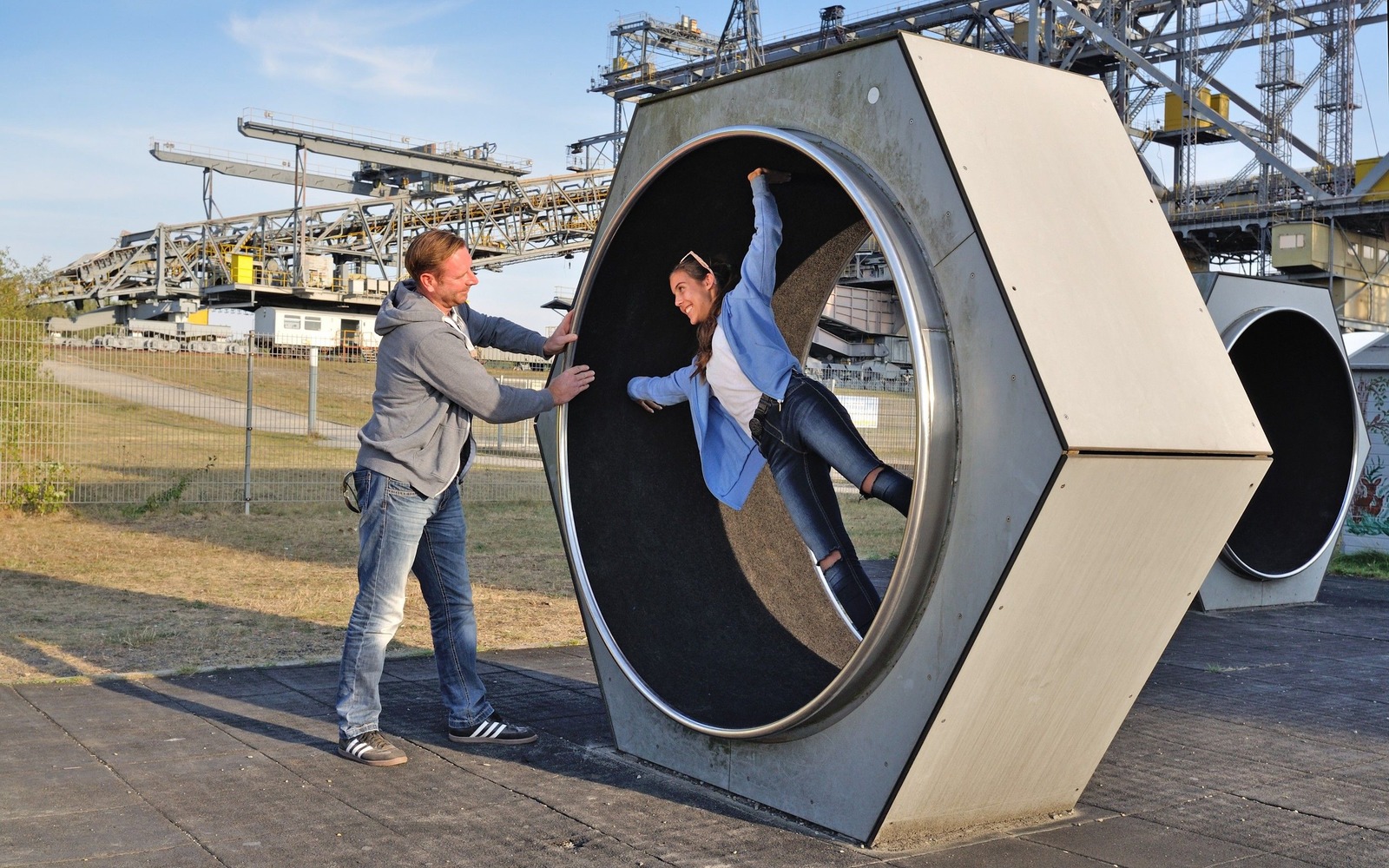
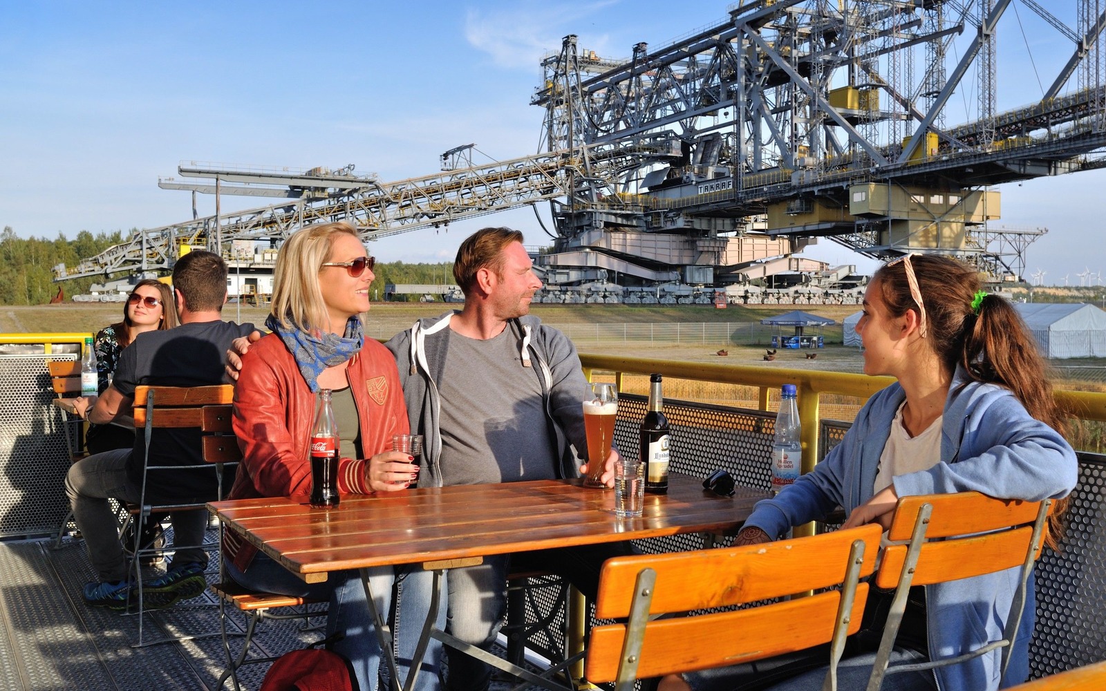
The shore of the flooded surface mining pit Bergheider See is home to a gigantic piece of technology: the F60 visitor mine. A visit to the former conveyor bridge marks the start of this tour. You then go on around the lakeshore of Bergheider See, where you will encounter many traces of mining activities that are reflected in the landscape: lignite deposits in a steep furrowed slope, man-made islands that symbolise the villages destroyed by mining activities, and the surprising natural paradise Grünhaus of the NABU (German environmental organisation) foundation for national natural heritage. The former surface mining sites are home to more than 3,000 animal and plant species, including rather spectacular ones such as hoopoes, cranes and sea eagles. The tour ends with a visit to a restaurant that narrowly escaped becoming a victim of surface mining along with the village Klingmühl. In Griebners restaurant you will go on a journey across time, back to the pub culture of the GDR. 

Length: 25 kilometres, without a detour to Sallgast (13 kilometres)

Start/finish: Visitor Mine F60 in Lichterfeld

Logo/route sign: The tour is not signposted

How to get there:
  • Train: From Berlin central station, you can go to Finsterwalde via Cottbus or Calau. Continue by bike from here. The Visitor Mine F60 is about 7 kilometres from Finsterwalde.
  • Car: From Berlin or Dresden, take the motorway A13 to the exit Großräschen. Continue towards Finsterwalde. Turn left towards Licherfeld in Lieskau. In Lichterfeld turn left towards the Visitor Mine F60.

Route: ​Lichterfeld, Bergheider See, nature conservation areas of the NABU foundation, former village Kostebrau-Römerkeller, Klingmühl, Sallgast (detour)

Route description: The tour starts at the F60 visitor mine. In the past, this huge machine was used to transport material that was layered above the lignite seams. Type F60 conveyor bridges are 502 metres long and 80 metres tall, making them the biggest mobile equipment in the world. After the tour that lasts 1.5 hours and maybe a snack at the rustic snack bar “Steigerstube” in the workshop wagon, you will start your tour by going towards the circular path around the lake Bergheider See to the north-east. The lake was created when the pit of the former surface mine Klettwitz-Nord was flooded, starting in 1992. Many traces of mining are still visible in the landscape.

The first part of the tour takes you through the former surface mining sites, on which lignite used to be extracted from open pits. The gravel path takes you to the south in a straight line, along the eastern shore of the lake. You cycle along with the water surface to your right, and a steep furrowed slope to your left that is about twelve to fifteen metres high. Here you can see traces of geological history, such as soil layers and lignite deposits.

A little further to the south, you will spot two little islands in the lake, close to the shore. These stand for the former village Bergheide (Gohra). The path continues to the southern shore with lovely views of the lake and the impressive F60 conveyor bridge. Here you may want to park your bicycle for a moment and climb the observation hill. It allows for stunning views of the nature paradise Grünhaus that is managed by the NABU (German environmental organisation) foundation for national natural heritage. The NABU foundation has purchased huge areas of this landscape. The former surface mining sites are still home to more than 3,000 animal and plant species, including rather spectacular ones such as hoopoes, cranes and sea eagles. The path will now take you to the country road no. 60 and then north towards Lichterfeld. About half-way, you will gross the so-called conductor canal, which is a non-navigable canal. The village Lichterfeld soon comes back into view. You can now choose to turn right towards the F60, or go directly to the wide sandy beach on the shore of Bergheider See to take a relaxing break.

You continue by going to Klingmühl, which is located about 3 kilometres to the north-east. Planning provided for this village to also be demolished in the early 1990s, and most residents had already left. Only the Griebner family who were the landlords of the inn and a few others remained. However, the mine was closed down and Klingmühl escaped demolition. It is now a thriving village once again. In Griebners restaurant you will go on a journey across time, back to the pub culture of the GDR.

Detour: A detour to the castle grounds in Sallgast is very worthwhile. You will reach the little castle by cycling across the forest from Klingmühl for about 15 to 20 minutes. Sophisticated regional cuisine is served at the Hotel in the castle grounds in Sallgast. Luckily, the village and castle of Sallgast also escaped being demolished to allow for surface mining activities.

Possible combinations: Long Distance Cycle Route no. 6, Prince Pueckler Cycle Path and Lignite, Wind and Water Tour

Trail conditions/surface: unpaved but very good gravel paths and quiet country roads

Maps/Literature: 
  • Pocket guide with tour description in PDF format, available for download from the website of the Energy Route of Industrial Culture in the Lausitz Region
  • Sängerstadt Finsterwalde - Doberlug-Kirchhain und Umgebung No. 62, 1:50 000, Sachsen Kartograhpie, Auflage: 2 (6/2011), ISBN-978-3-86843-062-2, Euro 5.50
  • Senftenberger See und Umgebung No. 55, 1:50 000, Sachsen Kartograhpie, Auflage: 4 (8/2014), ISBN-978-3-86843-055-4, Euro 4.90
Radtour ab dem Besucherbergwerk F60, Foto: Nada Quenzel
Am Besucherbergwerk F60, Foto: Nada Quenzel
Geführter Rundgang über das Besucherbergwerk F60, Foto: Nada Quenzel
Im Werkstattwagen am Besucherbergwerk F60, Foto: Nada Quenzel

Tour start

Besucherbergwerk F60
Bergheider Straße 4
03238 Lichterfeld

Tour end

Besucherbergwerk F60
Bergheider Straße 4
03238 Lichterfeld

Contact address

Markt 1
03238 Finsterwalde

Contact details

Contact: Tourist-Information Finsterwalde
Telephone: 035322 6888516
Email: info@elbe-elster-tourismus.de
Website: www.elbe-elster-tourismus.de

Diese Karte kann nicht von Google Maps geladen werden, da Sie in den Datenschutz- und Cookie-Einstellungen externen Inhalten nicht zugestimmt haben.

Datenschutzhinweise & Cookie-Einstellungen

Diese Website nutzt Cookies und ähnliche Systeme für essentiell notwendige Funktionen der Website (Rechtsgrundlage Art. 6 Abs. 1 lit. f DSGVO), zur Einbindung von Inhalten und Funktionen Dritter sowie der statistischen Messung (Rechtsgrundlagen Art. 6 Abs. 1 lit. a DSGVO in Verbindung mit § 25 Abs. 1 S. 1 TTDSG). Je nach Funktion werden dabei Endgeräteinformationen und/oder personenbezogenen Daten an Dritte weitergegeben und von diesen verarbeitet. Ihre Einwilligung hierfür können Sie nachfolgend erteilen. Ihre Einwilligung erstreckt sich auch auf die Datenübermittlung an Anbieter in den USA. Wir weisen darauf hin, dass nach der Rechtsprechung des Europäischen Gerichtshofs die USA derzeit kein mit der EU vergleichbares Datenschutzniveau haben und das Risiko der unbemerkten Datenverarbeitung durch staatliche Stellen besteht. Diese Einwilligung ist freiwillig, für die Nutzung unserer Website nicht erforderlich und kann jederzeit über die Schaltfläche "Cookie-Einstellungen" am Ende der Seite widerrufen werden.

Zur Datenschutzerklärung und den Cookie-Einstellungen.

Allen zustimmenEinstellungen

Datenschutzhinweise & Cookie-Einstellungen

Bitte beachten Sie, dass technisch erforderliche Cookies gesetzt werden müssen, um wie in unseren Datenschutzhinweisen beschrieben, die Funktionalität unserer Website aufrecht zu erhalten. Nur mit Ihrer Zustimmung verwenden wir darüber hinaus Cookies zu Analyse-Zwecken. Weitere Details, insbesondere zur Speicherdauer und den Empfängern, finden Sie in unserer Datenschutzerklärung. In den Cookie-Einstellungen können Sie Ihre Auswahl anpassen.

PHP Sitzung
Das Cookie PHPSESSID ist für PHP-Anwendungen. Das Cookie wird verwendet um die eindeutige Session-ID eines Benutzers zu speichern und zu identifizieren um die Benutzersitzung auf der Website zu verwalten. Das Cookie ist ein Session-Cookie und wird gelöscht, wenn alle Browser-Fenster geschlossen werden.
Auflösung
Das Cookie resolution speichert die Bildschirmgröße und wird an unsere Server übertragen. Damit können wir Ihnen Bilder in der passenden Auflösung ausliefern. Das schont Ihre Bandbreite.
Karte immer laden
Das Cookie loadMapAlways speichert ob die Karte eines POI´s automatisch geladen und angezeigt werden soll.
Favoriten
In dem Cookie favourites werden die von Ihnen gemerkten Seiten abgelegt, damit Sie sie zu einem späteren Zeitpunkt wieder finden und erneut aufrufen können.
Schriftgröße
Das Cookie fontSize speichert die von Ihnen für die Website eingestellte Schriftgröße. Dies erhöht die Benutzerfreundlichkeit der Seite, besonders für Menschen mit Seheinschränkungen.
Google Maps
Google Maps ist ein Karten-Dienst des Unternehmens Google LLC, mit dessen Hilfe auf unserer Seite Orte auf Karten dargestellt werden können.
YouTube
YouTube ist ein Videoportal des Unternehmens Google LLC, bei dem die Benutzer auf dem Portal Videoclips ansehen, bewerten, kommentieren und selbst hochladen können. YouTube wird benutzt um Videos innerhalb der Seite abspielen zu können.
Vimeo
Vimeo ist ein Videoportal des Unternehmens Vimeo, Inc., bei dem die Benutzer auf dem Portal Videoclips ansehen, bewerten, kommentieren und selbst hochladen können. Vimeo wird benutzt um Videos innerhalb der Seite abspielen zu können.
Google Tag Manager
Der Google Tag Manager ist ein Tag Management System, mit welchem Tracking-Codes oder Code-fragmente (z.B. Webanalytics-Systemen oder Remarketing Pixel) auf lausitzerseenland.de eingebunden werden.
Facebook Pixel
Cookie von Facebook, das für Website-Analysen, Ad-Targeting und Anzeigenmessung verwendet wird. Anbieter: Meta Platforms Ireland Limited, 4 Grand Canal Square, Dublin 2, Ireland. Cookie Namen: _fbp,act, c_user,datr, fr, m_pixel_ration, pl, presence, sb, spin, wd,xs. Cookie Laufzeit: Sitzung / 1 Jahr
Google Analytics
Google Analytics installiert die Cookie´s _ga und _gid. Diese Cookies werden verwendet um Besucher-, Sitzungs- und Kampagnendaten zu berechnen und die Nutzung der Website für einen Analysebericht zu erfassen. Die Cookies speichern diese Informationen anonym und weisen eine zufällig generierte Nummer Besuchern zu um sie eindeutig zu identifizieren.